
The City of Amarillo is providing this information as a public service. The data shown is for information purposes only and except where noted, all of the data or features shown or depicted on this map are not to be construed or interpreted as accurate and/or reliable; the City of Amarillo assumes no liability or responsibility for any discrepancies or errors for the use of the information provided.
Disclaimer: This product is for informational purposes and may not have been prepared for or be suitable for legal, engineering, or surveying purposes. It does not represent an on-the-ground survey and represents only the approximate relative location of property boundaries.
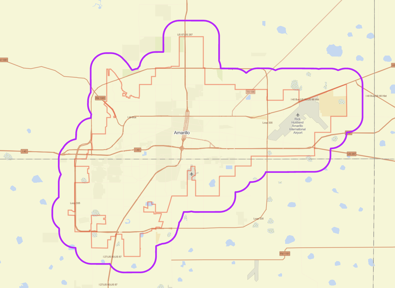
PRAD Data (Potter Randall Appraisal District): Offers detailed information on individual land parcels, including ownership and property lines, critical for property assessment and planning.
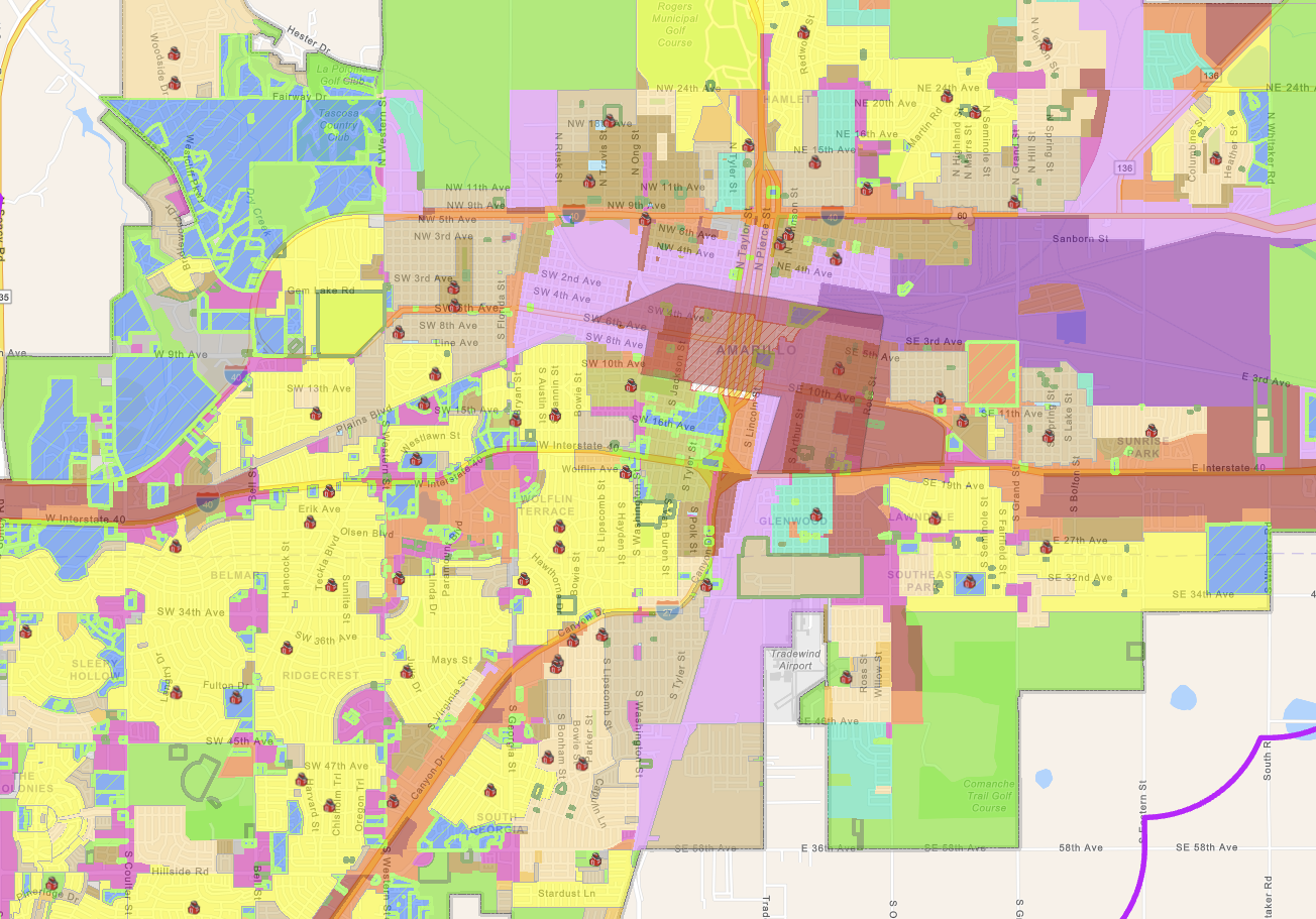
A general GIS (Geographic Information System) Planning Map is a valuable tool used in urban planning and development. GIS Planning Maps help planners, developers, and the public make informed decisions regarding land use, zoning changes, and infrastructure projects.
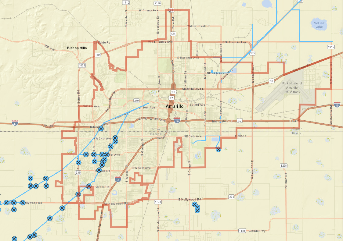
The Underground Utilities Map of Amarillo provides detailed information about the city’s infrastructure. This map is essential for construction, maintenance, and urban planning, helping to avoid damage to utilities and ensure proper infrastructure management.
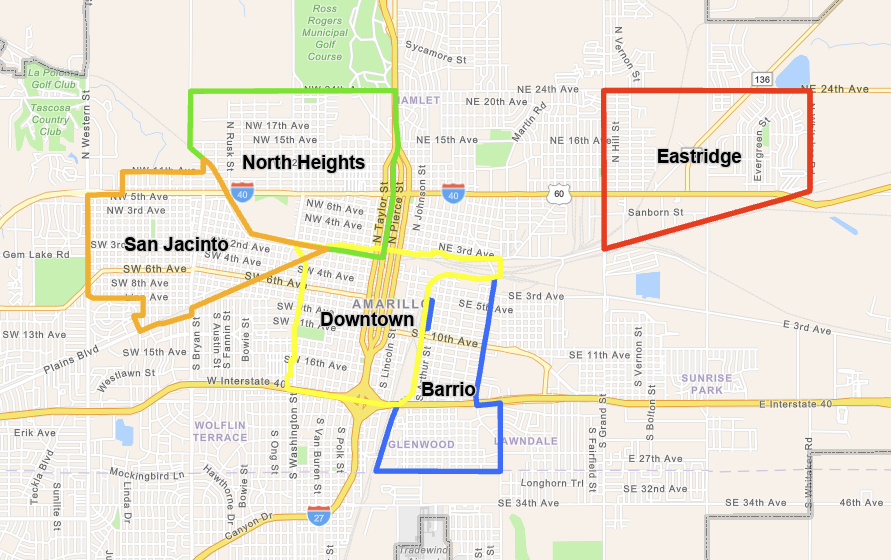
This map provides a strategic overview of economic development opportunities in Amarillo, Texas, highlighting key areas and resources that can support business growth, investment, and community revitalization.
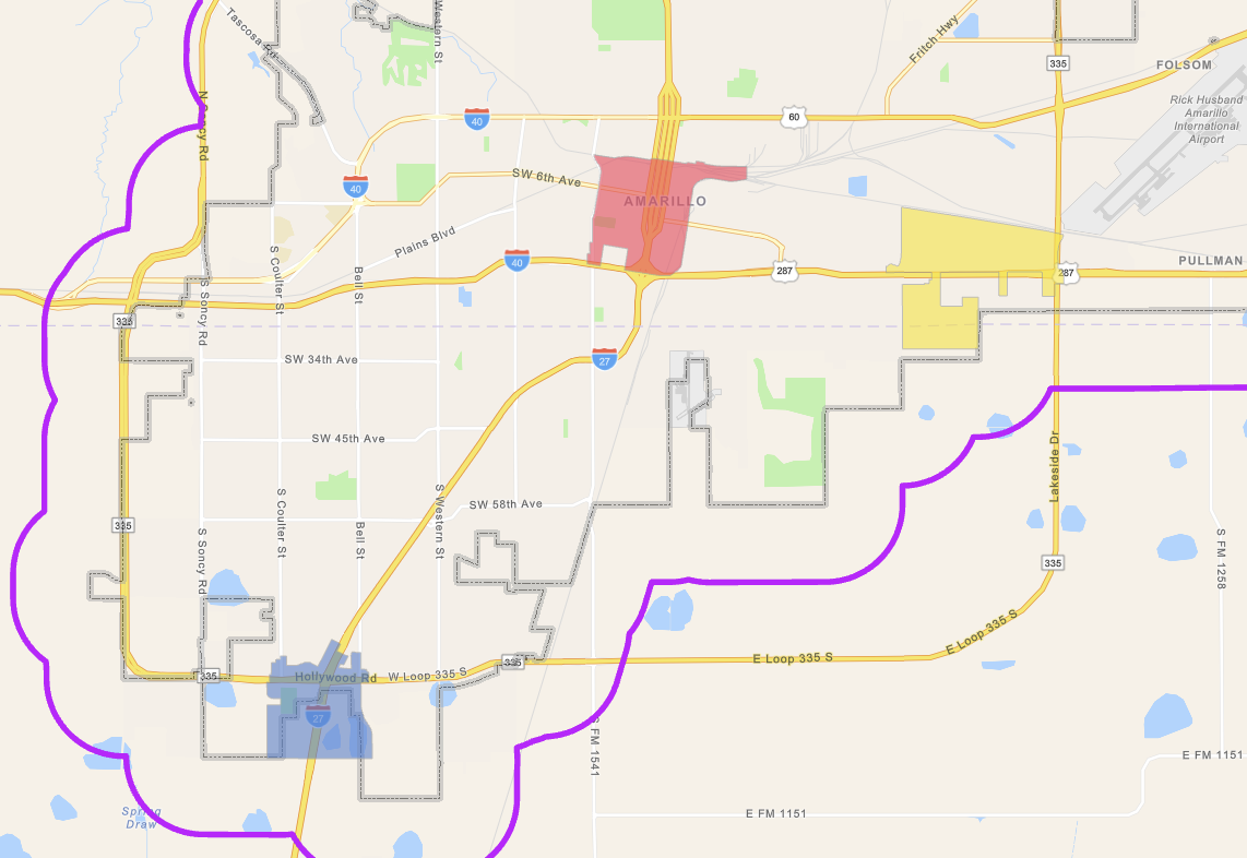
This map provides a strategic overview of economic development opportunities in Amarillo, Texas, highlighting key areas and resources that can support business growth, investment, and community revitalization.
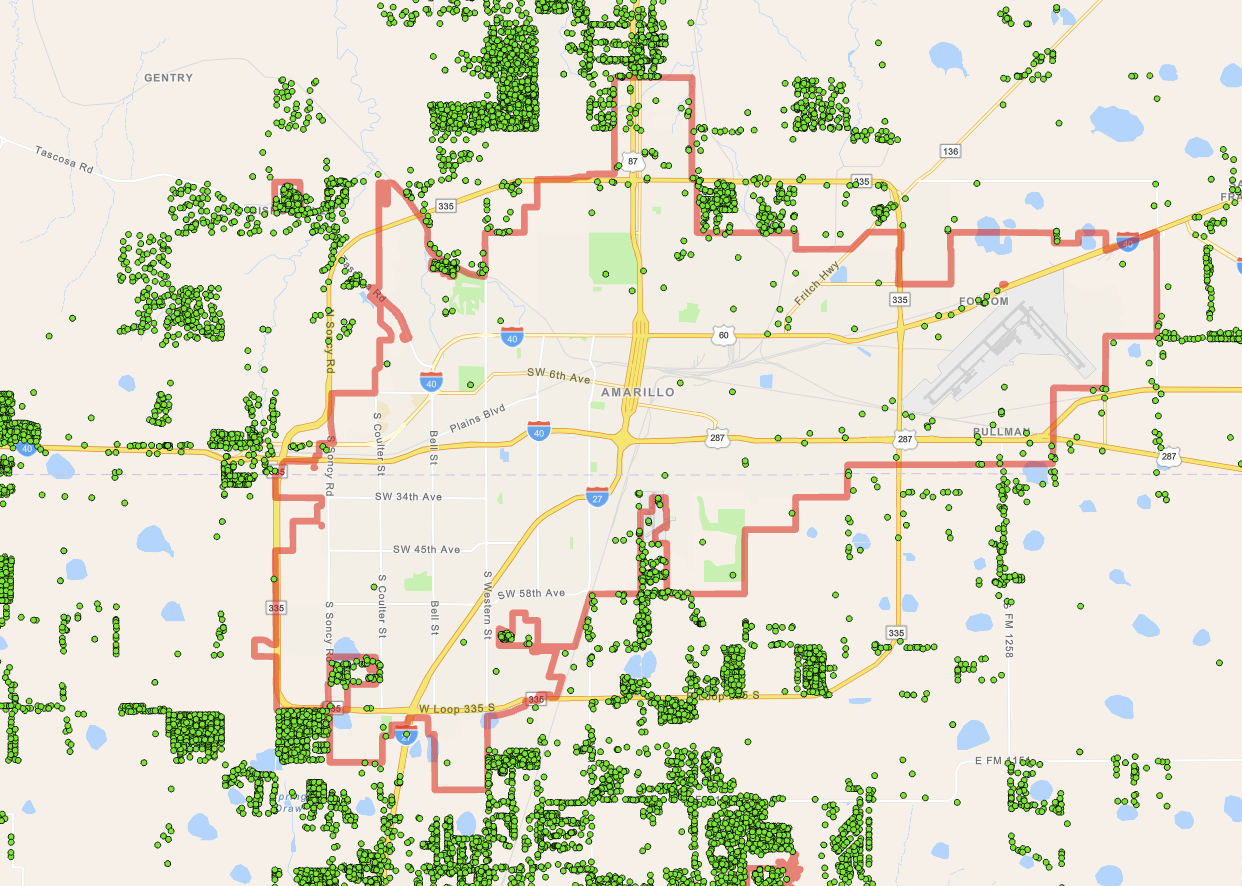
This map offers a detailed and view of onsite sewage facilities in and around the Amarillo area.
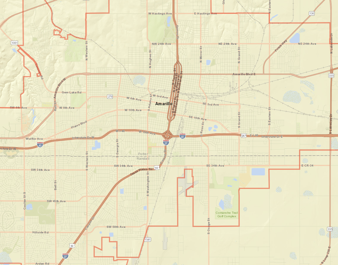
This is the City of Amarillo’s Pavement / ROW Mapping Application. The end user will be able to determine distances from curb to property lines.
The City of Amarillo offers translations of content on Amarillo.gov through the Google Translate web translator (translate.google.com). Because Google Translate is an external service, the City does not control the quality or accuracy of translated content. As a result, some translations may contain inaccuracies, and there may be issues with the appearance of translated pages, including errors in images.
If you encounter incorrect or substandard translations, you can help improve them by contributing better translations using Google Translate:
For more information on contributing to Google Translate, visit Google Translate’s help page.
Please note that the City of Amarillo does not control the process by which contributed translations are incorporated into Google Translate.
The City of Amarillo is dedicated to enhancing the accessibility and multilingual content available on our website.
The chart shows the dollar amounts of property taxes rebated per year over the last five fiscal years, broken down by agreement type. There were no Chapter 380 property tax rebates in the first two years listed. The total amount increased slightly each year, with a more significant increase in the most recent year.
Numerical values presented on the image:
| Fiscal Year 2020/2021 | Fiscal Year 2021/2022 | Fiscal Year 2022/2023 | Fiscal Year 2023/2024 | Fiscal Year 2024/2025 |
Chapter 311 | $533,080 | $547,426 | $574,947 | $591,249 | $821,350 |
Chapter 380 | $0 | $0 | $37,387 | $39,172 | $61,013 |
The bar chart shows the amount of property taxes rebated in the past five fiscal years, broken down by agreement type. The horizontal axis shows each of the past five fiscal years and the vertical axis shows the dollar amount rebated. For each fiscal year there is vertical column, comprised of two stacked columns, each of which representing the different agreement types.
The chart shows the number of businesses that received a tax abatement from the City of Amarillo in the past five fiscal years. The 2020/21 and 2021/22 fiscal years each had four active abatements, 2022/23 had five, and 2023/24 and 2024/25 each had seven.
Numerical values presented on the image:
| Fiscal Year 2020/2021 | Fiscal Year 2021/2022 | Fiscal Year 2022/2023 | Fiscal Year 2023/2024 | Fiscal Year 2024/2025 |
Active Abatements Per Year | 4 | 4 | 5 | 7 | 7 |
The bar chart shows the number of businesses that received a tax abatement from the City of Amarillo in the past five fiscal years. The horizontal axis shows each of the past five fiscal years and the vertical axis shows the number of active abatements each year. Each year has one column, with the height indicating number of active abatements in that year.
The chart shows the dollar amounts abated over the past five fiscal years from Chapter 312 tax abatement agreements. Each fiscal year shows a larger dollar amount abated, with minor growth over the first three years, a higher increase in the fourth year, and minor growth again in the fifth year.
Numerical values presented on the image:
| Fiscal Year 2020/2021 | Fiscal Year 2021/2022 | Fiscal Year 2022/2023 | Fiscal Year 2023/2024 | Fiscal Year 2024/2025 |
Taxes Abated by City of Amarillo | $510,061 | $623,017 | $679,849 | $965,261 | $1,143,899 |
Total Abated by All Entities Including City of Amarillo | $1,569,512 | $1,926,332 | $2,103,099 | $2,884,936 | $2,959,496 |
The bar chart represents the amount of taxes abated over the past five fiscal years. The horizontal axis shows each of the past five fiscal years and the vertical axis shows the dollar amount abated. The bar representing taxes abated by the City of Amarillo is sightly offset to the side of the bar representing the amount abated by all participating tax entities for each fiscal year. This shows that the amount abated by the City of Amarillo is a part of the total amount abated by all entities.
This chart shows the dollar amounts rebated by the City of Amarillo from economic development incentive agreements over the past five fiscal years. Each year is broken down by rebate type, including property tax rebates, hotel occupancy tax rebates, and sales tax rebates. Each fiscal year shows a slight increase in total dollars rebated, with a more drastic increase in the most recent fiscal year.
Numerical values presented on the image:
| Fiscal Year 2020/2021 | Fiscal Year 2021/2022 | Fiscal Year 2022/2023 | Fiscal Year 2023/2024 | Fiscal Year 2024/2025 |
Property Tax Rebates | $533,080 | $547,426 | $612,334 | $630,421 | $882,363 |
Hotel Occupancy Tax Rebates | $686,747 | $753,112 | $794,828 | $871,423 | $808,348 |
Sales Tax Rebates | $0 | $21,046 | $55,528 | $45,881 | $368,716 |
The bar chart represents the amount rebated by the City of Amarillo for each type of tax rebate over the past five fiscal years. The horizontal axis shows each of the past five fiscal years and the vertical axis shows the dollar amount rebated. The different rebate types are stacked vertically in each fiscal year, with the height representing the total dollar amount rebated.